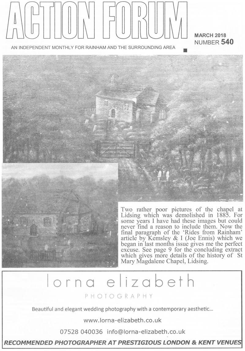
ST MARY MAGDALENE'S CHAPEL, LIDSING by ALAN WARD
The site of St Mary Magdalene's Chapel, Lidsing (pronounced Lidsin) is today overgrown with trees and scrub. This structure, situated at Ordnance Survey grid reference TQ 7911 6324, was similar in size and probably of much the same date as the chapels at Dode and Paddlesworth. The chapel was sited at the head of what is today a dry valley and overlooks the Hempstead Valley 'Sava Centre'. The soil on this part of the dip slope of the North Downs is for the most part clay-withflint and would be very hard for a community of the medieval period, or earlier, to plough.
The area was perhaps primarily coppice woodland and pannage for pigs. (Hasted's map shows extensive woodland near the chapel - Fig. 1). In the medieval period it seems likely that this shallow valley would have contained a spring-fed stream. Until the nineteenth century the Luton Brook flowed from a point about two miles further down this valley, and still flows below 'The Brook' at Chatham today. The presence of a good permanent water source was always one of the pre-requisites for the development of a settlement. If permanent surface water did not exist then a settlement (whatever the period) would almost certainly never start at a specific place. It has been suggested that the water table below the South Downs has dropped by as much as 30m in the last hundred years, due mainly to increased demand (Jacobi 1978, 77). There is no reason to believe that the natural reserves of water below the North Downs have had any less demand put upon them. It seems likely that this 'chapel-of-ease'1 was founded close to a permanent water source and served the dispersed population of the surrounding area, who lived up to four miles away from the parish church of Gillingham. In the late medieval period (and no doubt both earlier and later) some of the parishioners from that part of Boxley parish situated on the dip slope of the North Downs also seem to have used this chapel (see list of offerings below). This would of course mean they would not have to undertake the journey down and then back up Boxley Hill.
According to popular tradition the hamlet of Lidsing lost its population because of the Black Death 1348-50 and subsequent outbreaks of bubonic plague. This may be true, but perhaps not in the accepted sense. The twelfth and much of the thirteenth century had seen population expansion onto marginal agricultural land. It had to be farmed to feed the excess population. The clay-with-flint deposits would have been marginal from a purely agriculture point of view and the population of Lidsing was probably by necessity well scattered. It is conceivable that such a population might stand more chance of surviving an outbreak of plague. Those who did survive would find that more fertile plots were readily available and consequently the population of the hamlet may have been reduced as much by movement as by death. An intensive study of the considerable number of medieval documents relating to Lidsing and adjacent areas (Bredhurst, Hempstead, and Walderslade, with the significant place name of Tunbury2 nearby) might show whether or not this scenario is true. That the medieval chapel was still in use in the sixteenth century shows that there was sufficient local population, despite the ravages of the late fourteenth and fifteenth century plague outbreaks, to keep the structure in being.
Documentary Evidence
As with the majority of medieval buildings the primary documentary references that survive only give us a glimpse of the development of this structure. However, in one respect we are extremely lucky for a plan was made perhaps several decades before the chapel was demolished in the 1880s. This plan, drawn at a scale of 1:48, is annotated with measurements and shows the position of the pews within the nave (Medway Archive Office Document P153C 3/2). Medieval documents relating to the chapel itself are, of course, few and far between, but it is mentioned in the Textus Roffensis of c. 1110 (Ward 1932, 53). Whilst Gordon Ward (no relation) implies that most of the structures mentioned within this important collection of documents will be of Anglo-Saxon date, we should be more circumspect. A pre-Conquest date would be possible, but there was more than sufficient time between 1066 and c. 1110 for the establishment of entirely new structures, and indeed settlements. Even if the list of churches mentioned in the Textus was drawn up in 1077, as Gordon Ward favours, there had still been (Just) enough time for an entirely Norman creation. Whilst we would all want an Anglo-Saxon origin for Lidsing (or indeed any other church) we should be careful about assigning a pre-Conquest date unless there is conclusive physical or documentary evidence.
There is perhaps slight evidence to suggest the chapel was in fact early Norman (see below). Henry I (1100-1135) apparently gave the chapel along with its mother church at Gillingham to Minster-in-Sheppey Abbey (Coles Finch 1925, 256). Thereafter the chapel seems not to be mentioned again until 1448 when it appears in a rental (Rogers c. 1947, 105, quoting British Museum Additional MSS 33902 Vol. xxv). It is then mentioned in several wills and other documents of the late fifteenth and early sixteenth centuries:
a) 1498 Thomas Strete of Boxley gave 20d to the High Altar at Liggying.
b) 1500 Joan Busshe of Boxley gave 20d for repairs at Lydsing church.
c) 1505 Isabella Clifford of Newington-next-Sittingbourne gave 8d to the chapel at Leghing.
d) 1526 Thomas Taunton of Bredhurst gave 3s 4d.
e) 1530 John Kemsley of Gillingham gave 'ten owyes there to remaye for euer to the most p'ffitt of the chapel' at Leggyn.
f) 1530 John Kemsley 5s 7d for gilding and painting the chapel at Liggyn. (a-d, Hussey 1911, 237-8; e-f, Duncan 1898, 143-4)
All the tithes of the hamlet of Lidzying were awarded to the chapel and in a Parliamentary Survey of 1647 were valued at £25 per year (Hasted 1972, 243).
Of greater interest (and certainly more entertainment value) a petition to the House of Commons dating to 1642 complained that the vicar, Richard Tracey of Boxley, had not preached nor undertaken divine service at the chapel for twenty weeks (Baldwin 1998, 152). For three years he had not administered the sacrament nor sent a curate in his place. It was also alleged the vicar had hit the clerk of Bredhurst. In his defence the vicar alleged that the petition was invalid as one of the petitioners, William Kemsley, was blind drunk at the time of signing and by implication two others, Moses Long and John Paine, who signed it in an ale house, were in a similar state. A fourth petitioner had been bribed by the promise of having a house built! The vicar admitted striking the clerk but only because the latter was drunk and had fallen asleep during a church service.
The vicar survived these particular complaints but was removed (as with many others) during the Commonwealth. By 1718 the church had supposedly become derelict. In that year an account was written which tells us that the church was overgrown with ivy, that there were no gravestones nor inscriptions and that the font had gone, there being only a pedestal at the west end where it had once stood. There were no bells 'nor nay place to hang them' (Rogers c. 1947, 105). However, the account whilst implying a sorry state of affairs is not actually stating the church is derelict or out of use. The church, not ruins, is stated as being overgrown with ivy, the lack of grave markers could indicate the poverty of the rural inhabitants and the moveable items had possibly been stolen, which of course is why most churches today have to be kept locked!
The situation certainly improved whilst the Revd John Jenkinson was the Vicar of Gillingham (1753-87). The east end was rebuilt in brick at his own expense (Hasted, 243; Coles Finch 1925, 256). As the word 'rebuilt' is used it is safe to assume there was an earlier stone chancel. However, amongst the entries within the Churchwardens account book, which survives from 1727-1775 (MAOD P153C 5/1; Rogers c. 1947', 130-1), it can be seen that this process of improvement had begun earlier. The thirteen ratepayers of the middle decades of the eighteenth century paid for the following: 1727. 'Going the bounds' the sum of 5 shillings; for mending the 'cappel' yard 1/6; for two hedgehogs 8d. 1735. Paid to the Chapel Warden, Thomas Sawyer: for mending the chapel door 21- and six foxes heads 6/-. 1737. Mending the windows; hedging the churchyard. 1739. Paid to the Chapel Warden, William Broad for: mending the windows 11-; for washing the 'surples' 2/6; for a polecats head 4d; [and enigmatically] paid for a warning 4/-.
1746. Mending the windows.
1752. Mending the chapel and going to the bounds. There is enough detail within these documents (MAOD P153C 5/1) to tell us that the chapel was still in use, certainly from 1735, and perhaps had never been totally abandoned prior to the Revd Jenkinson taking up office. However, once he becomes vicar the extent of repair work definitely seems to have increased (and perhaps included the repairs of 1752):
1756, 1758 and 1762. Repairing the windows (this was obviously a recurring problem; was this due to eighteenth century vandalism?).
1760. Ironwork for the chapel gate.
1766. Bricklayers, carpenters, blacksmiths (and 'shearslayers'?) were at work, perhaps indicating the time of the rebuilding of the chancel. The chapel door locks were also mended.
1769. 1771, 1775. Bricklayers.
1770. Carpenters and bricklayers.
1771. Chapel wood felled.
1774. Repairing lights. (In view of the previous use of the word 'windows', the 'lights' are possibly lamps within the church rather than referring to the architectural sense of the word.)
However, ratepayers expenditure was primarily for paying the clerk's wages, court fees, visitation expenses, vestments, brushing the chapel yard and rewards for the catching of vermin, which included sparrows as well as the hedgehogs, polecats and foxes mentioned above. For foxes (and badgers) only heads had to be produced to collect a bounty.' By Hasted's day there was only one service a month for the six houses within the district. However a bell turret was added at a date after 1821 (Coles Finch 1925, 256) and it would seem that there was still sufficient income for the chapel to be kept in good repair. The bell turret is not shown on the attractive 'idyllic' drawing of the chapel from the Gentleman's Magazine of 1820 (Plate I). Two mid-nineteenth century paintings by Henry Hill exist within the local study collection at Gillingham Library. They differ slightly from one another, and from the other surviving illustrations, but we must allow for artistic licence.
The chapel on the day prior to demolition, photographed by Henry Hill who also painted two pictures (now in the local study archive at Gillingham Library). The two paintings show the chapel much as it was in I 820 but with the addition of the bell turret. Both the nave windows have brick surrounds. A collar is just visible along with what is believed to be a side purlin supporting the rafters on the south. In Plate III the corresponding side purlin on the north unfortunately cannot be seen. Above the door there may be indications of a Romanesque arch. Three illustrations of the chapel (Plates II, III and IV) made immediately prior to its demolition show that the roof had gaping holes and that the bell turret had collapsed. When the chapel was demolished the bell was removed to an engineering works in Chatham for use as a time toll for the workmen (Coles Finch 1925, 257) although Ron Baldwin states R. D. Batchelor of Darland Farm4 used it. The door was removed to Restoration House. Rochester, at that time owned by Stephen Thomas Aveling, local engineer and collector. According to the faculty for demolition dated to the 3rd April 1883 the chapel was ancient and ruinous, partly unroofed and open to the wind and weather:5 the building was 'deemed dangerous to human life especially of the children who play within and near the building'
(MAOD P153C 3/3). Permission for demolition was therefore given. The materials were to be sold off, any surplus money for this sale was 'to be expended on repair of the walls and fences of the graveyard and the decent preservation of such ground' .6 Divine service by this time had been discontinued and the thirty-five inhabitants of Lydsing had not elected a churchwarden for many years. However, Coles Finch implies that he had met parishioners who had worshipped in the chapel even when well-decayed, for he tells us that the rain fell upon their heads during the sermons (1925, 256). According to Coles Finch the parish chest had been broken into and its papers dispersed, and no doubt used to kindle the fires lit within the chancel by children and wayfarers. It is perhaps surprising that any of the parish documents survive. Interestingly Coles Finch gives the date for the demolition of the chapel as 1886, after having been partially destroyed by fire, rather than 1884 as implied by Rogers, or 1883 as stated by John Guy (1981). The faculty probably gave permission for demolition to take place but it was probably not actually carried out until slightly later.
Archaeological Information
Settlement in the Lidsing area may be of earlier origin for a pagan Anglo-Saxon burial was found in 1881 within Little Knock Wood and reported to George Payne (1888, 149). This burial was about a metre below the surface and produced pottery vessels and a bead necklace. It is assumed that the burial was found near Little Knox cottage, a quarter of a mile to the west of the chapel site. The important piece of information that there were large amounts of tufa used within the fabric of the chapel was recorded by C. S. Leeds (1906, 35). This apparently suggests an early Norman date (Livett 1895, 266) which accords well with the first documentary evidence supplied by the Textus Roffensis. However, one of the paintings by Henry Hill may show a long and short quoin at the east end of the south wall. Such an architectural detail is, of course, usually regarded as being of Anglo-Saxon date. None of the other illustrations show the position in enough detail to clarify the point. However, even if Hill's painting is correct, such a building tradition could easily have lasted for a generation after 1066, especially in a rural area. Whilst the present writer favours an early Norman foundation it is obvious that the precise date of the chapel is open to debate.
Even complete excavation would be unlikely to clarify the matter. Hasted tells us that the chancel or east end was rebuilt in brick (1972, 243). However, Plate IV shows that it was only the east wall that was rebuilt in brick, along with the clasping buttresses, rather than the chancel as a whole. In their original colours the two paintings by Henry Hill give different information; one suggests brick, whilst the other seems to show stone. However, artistic licence can again easily account for this discrepancy. He also omits the two buttresses protruding from the east wall and instead shows a buttress formed by the east wall of the nave and south wall of the chancel. No other illustration shows the feature, and this also is regarded as artistic licence; possibly the paintings were made from rough sketches and memory. Interestingly there are no windows within either the south or north walls of the chancel and interior lighting would therefore have been necessary.
However, Plate III may show very faintly a blocked window arch within the north wall. We know that there were no monuments within the church immediately prior to demolition (MAOD P153C 3/3). Four gravestones are shown on the south side of the chapel on Henry Hill's paintings along with at least eight unmarked graves. In 1906 three readable gravestones remained. The best preserved was to Thomas Johnson son of William and Mary Johnson who died 10th August 1863 aged 43 years leaving a widow and four children. The remaining two gave less information, John Mills, d.1865 aged 33 years; George Jarret, d.1871 aged 76 years (Leeds 1906, 35). Three stones were still visible in 1919 (Baldwin 1998, 153). Coles Finch tells us that only two could be found with difficulty in his day, one dated to 1863, presumably that of Thomas Johnson and another to 1859 (1925, 257). These two stones were photographed c. 1927 by Ron Baldwin7 and were still visible as late as 1936 (Baldwin 1998, 153).
One of these stones still stood until after the Second World War (Rogers c. 1947, 105) and the broken fragments may remain where they have fallen. Local rumour has it that several houses in Bredhurst have tombstones from the chapel site for their doorsteps and that the font is in use as a birdbath.
8 Also, within the grounds of the (now demolished) old vicarage at Gillingham a stone arch had been erected possibly with stone from the chapel.
9 The pointed doorway (Early English, or possibly 'Transitional') in the south wall of the nave appears to have been the only entrance into the chapel. We know that this door was removed to Restoration House, Rochester on demolition (Coles Finch 1925, 257) and was apparently erected within the garden (Baldwin 1998, 152). What may be the jambs and arch of an (?inserted) stone door still survive within the house itself and could conceivably be that from the chapel. In the early 1960s an enthusiastic group of young archaeologists from the local Walderslade Boy's School uncovered parts of the walls of the demolished church.
10 In 1981 members of the Lower Medway Archaeological Research Group, at the instigation of the present writer, undertook field walking on the chapel site and the periphery of the adjacent field. Other than one fragment of Roman pottery only post-medieval sherds were recovered from the field. The late pottery is probably the residue of 'muck' spreading, perhaps from the smallholding that once stood 200m to the west. Within Chapel Woods the north-east corner of the chancel and buttress were visible at ground level and the east wall of the chancel was traced for a length of over five metres by removal of the accumulated leaf mould. The mortar bonding the flintwork of the east and north wall contained large numbers of cockleshells. The brick buttress was not bonded to the north wall thereby implying a later addition. The flint courses observed were probably of medieval date, although that does not preclude the walls having been rebuilt in the eighteenth century at a higher level. Demolition debris of broken peg tiles was noted at the west end of the chapel. There is every reason to believe that the lowest course of the walls and presumably the floor deposits will survive in relatively good condition, although tree roots will have caused some disturbance. A bank and ditch were noted to the south of the chapel and perhaps formed part of the churchyard perimeter. Various maps of the eighteenth and nineteenth century show several buildings in the immediate area and it might be possible for archaeological excavation to recover their remains.
The old Gillingham Borough Council was very much aware of the local interest of this archaeological site." If redevelopment should ever take place in the locality around and on the chapel site it is to be hoped that archaeological excavations will precede the work. The remains of the chapel itself could, and perhaps should, be cleared and consolidated for public view and the churchyard and adjacent woodland tidied up and made into a conservation area. This could be done without disturbing any burials. The remains of any grave-markers or other artefacts could perhaps be safely displayed within cabinets in the 'Sava Centre'. Comparisons with the chapels at Dode and Paddlesworth Lidsing chapel was similar in size and probably of much the same date as those at Dode and Paddlesworth, 7-8 miles away across the Medway valley (Plates V and VI). A comparative plan shows the three chapels drawn to the same scale (Fig. 2).
Lidsing chapel was described as 'being of little beauty and of no architectural pretensions' (Leeds 1906, 35), but if, as the present writer suspects, it was similar to these two wonderful little buildings that statement (to say the least) is rather hard. Whilst most parish churches have seen many additions these three chapels are, or in Lidsing's case would have been, little altered from when they were first constructed and thus provide detail which does not usually survive. The loss of Lidsing lessens the amount of material available upon which valid 'compare and contrast' interpretations can be made.
The chapels at Dode and Paddlesworth are now well maintained and lovingly looked after and on occasion open to the public, but even a walk around their exterior is well worthwhile. Both chapels may well have been for the use of dispersed populations although perhaps with Paddlesworth (mentioned in Domesday Book 1086) the presence of an impressive post-medieval structure nearby might imply that this chapel was originally the private chapel of the lord of the manor. Both chapels have tufa within their fabric and were regarded by Grevile Livett as being of early Norman date. As far as the present writer is aware there is no detailed, accurate modern guide-book to either building and Livett's late nineteenth-century account in Archaeologia Cantiana remains the best available.
ACKNOWLEDGEMENTS
The writer wishes to thank Ron Baldwin and Pauline Sieben for reading through an early draft of this work. This work is dedicated to Ron Baldwin who was one of the writer's first adult education teachers (nearly thirty years ago); he was also the first individual (and only lecturer) to encourage the present writer (along with his other students) to undertake individual projects. Without his help and encouragement this work (along with others already published and in preparation) would never have been written. The writer's thanks also go to Mick Diak and Andrew Linklater for reading through the final version of this report. Any errors are those of the writer.
NOTES
First so described in 1782 (Baldwin 1998, 152 quoting John Thorpe). The Concise Oxford Dictionary (1995) definition of this phrase is 'an Anglican chapel (built) for the convenience of remote parishioners'. As the Anglican Church didn't actually exist when the chapel was first built this definition is technically not correct. In practice of course the meaning remains valid.
If taken at face value the word Tunbury should indicate 'the settlement around the fortified place or manor house'. It is perhaps notable that Lordswood is also a prominent local place name.
If this unfriendly environmental outlook was taking place over the whole country it is surprising we have any wildlife left.
According to Geoffrey Hulton the bell was installed in Chatham Dockyard where it was used to call the men to work. The custom went out of use in the Second World War but was in use again in 1989 to mark the opening and closing of the Dockyard each day (Hulton 1993, 29). To the present writer it seems more probable that a local farmer would obtain the bell rather than a national Dockyard.
Phillip Rogers states an 'Order in Council' dated 14th April 1884 authorised demolition; (p. 105), but this document has not been traced.
This would imply that if there were no surplus, the funds for upkeep of the graveyard would have to be found from elsewhere. An interesting philosophical, ethical and possibly legal point then of course arises. It is possible that the 'decent preservation of the graveyard' should still be taking place. Needless to say the area has been used to dump rubbish although this has now been largely prevented by the closure of Chapel Lane and the site becoming overgrown.
The writer's thanks to Ron Baldwin of Gillingham for supplying copies of the photographs, but as they show little detail they are not reproduced here.
The writer's thanks to Jane Marvell of Hempstead for this information.
The writer's thanks to Jane Marvell, quoting a letter sent to her by David Murr of Gillingham, for this information.
The writer's thanks to Keith Gulvin for this information.
Personal communication: letter dated 4 July 1990.
REFERENCES
Baldwin, R. A., 1998, The Gillingham Chronicles.
Coles Finch, W., 1925, In Kentish Pilgrim's Land.
Duncan, L. L., 1898, 'Ecclesiological Notes Respecting the Deanery of Shoreham Kent', Archaeologia Cantiana, xxiii, 134-149.
Guy, L, 1981, Discovering Kent: 'Lost Chapel in Hempstead Woods', Evening Post 5 June 1981.
Hasted, E., 1797, The History and Topographical Survey of the County of Kent, 1972 edn., Vol. iv.
Hulton, G., 1993, Off the Beaten Track.
Hussey, A., 1911, 'Chapels in Kent', Archaeologia Cantiana, xxix, 217-258.
Jacobi, R. M.,1978, 'Population and landscape in Mesolithic lowland Britain', in The effect of man on the landscape: the Lowland Zone, ed. by S. Limbrey and J. G. Evans, pp. 75-85, CBA Research Report No.21.
Medway Archive Office Document (MAOD), P153C series:
1/1 Register of baptisms 1840-74.
1/2 Register of marriages 1840-55.
1/3 Register of burials 1840-76.
3/1 Valuation of underwood with coloured sketch map showing the chapel.
3/2 Ground plan of Lidsing Chapel mid-19th century.
3/3 Faculty for demolition 3rd April 1883.
3/4 Letter about demolition. 4th April 1883
5/1 Churchwardens 1727-75 (this document is too fragile to be handled, but its details are listed, but by using the archive precis and Rogers c. 1947 the gist of what is mentioned can be recovered).
11 Valuation of land. 27/1 Tithes 27/2 Tithes. 27/3 Tithes. 28 Historical description of the ville of Lidsing 1800-20.
Leeds, C. S.,1906, Chats About Gillingham.
Livett, G. M., 1895, 'Early Norman Churches In and Near the Medway Valley', Archaeologia Cantiana, xxi, 260-72.
Payne, G., 1888, Collectanea Cantiana.
Rogers, P., c. 1947, A History of Gillingham.
Ward, G., 1932, 'The List of Saxon Churches in the Textus Roffensis', Archaeologia Cantiana, xliv, 39-59.
Article published in Kent Archaeology
https://www.kentarchaeology.org.uk/sites/default/files/archcant/2000%20120%20St%20Mary%20Magdalene%27s%20Chapel%20Lidsing%20Ward.pdf?fbclid=IwAR2d85w3Od9EUpgopKcO1v-F_zSv2mfgHDSUrwpnbga6uNgh_akgNBLXnfs
- Details
- Category: History Articles
This leaflet advertising Abbey Homestead's Berengrave Park Project was developing the new estates of Childscroft Road, Chalky Bank Road, Parkfield adjacent to Berengrave Lane and the north side of the railway line. This development would have been during the late 1950s/early 1960s at a similar time to the Tilbury Road estates (details of Finwell Road Rainham 1967 - Rainham House Prices) on the opposite side of Station Road. The other roads included were Roystons Close, Bushmeadow Road, Wooldey Road, Dignals Close and Iversgate Close.
If you have any old photos taken on the estate that you could share it would be great to see them - please email
Photo below of Chalky Bank Road in 1961


There are also leaflets for the Parkwood estate building in the 1960s here - Parkwood Wards Homes Sales Brochures and Promo Leaflets 1960s


- Details
- Category: History Articles
Rainham Mark Building Estate was the name given to the development of Marshall Road, Edwin Road and Sylvan Road in the early part of the twentieth Century. Other old photos of Marshall Road are here
If you have any old photos taken on the estate that you could share it would be great to see them - please email
The land for Marshall Road and Edwin Road was sold off in the early 1920s with houses being constructed soon after. Unlike modern housing estates that are developed by a single company these were sold off as individual plots of land for the owner to build their own house or bungalow on. There was a 20ft building line specified which made sure houses weren't too close to the road. This was a very similar situation with my grandmother's house in Woodside that she had built in 1939 - read here and see the plans Costs of Building in Woodside,Wigmore 1939
Plots were sold off in various sizes - some were 20 foot wide, some 40 foot and some 60 foot by being combined so they were wider than the original sales brochures suggested. The 40 foot plots were £60 and the 60 foot wide plot for the house shown cost £90 by combining one plot and half of the next one as can be seen in the map and documents below.
You can see on this photo of Rainham Mark in 1920 that the photo would have been taken roughly where junction between Edwin Road and A2 Watling Street is now but it's unclear if Edwin Road was here at the time. Note the advert on the side of the shop for Esi-Run Villas from £395 which were the houses on Caldew Avenue, Hawthorne Avenue and Begonia Avenue which was being developed along with other sites at that time but those houses were being sold as complete buildings to move into rather than selling off the plots of land. The difference was that it cost £395 for the fully built house or £60 for the plot of land.

The roads were named after Marshall Harvey and Edwin Jelly who owned and sold the land. From the contract details that I've seen it would suggest that Marshall Harvey and Edwin Jelly jointly acquired the land for what they called the Rainham Mark Building Estate and then parcelled it off to sell to individuals. Other land around was still owned by the War Department (now Tesco Extra and A289 link road & Gillingham Business Park) and Lord Hothfield. Marshall Harvey is listed as being the Accountant for the Wakeley Brothers in 1888 and involved in other land deals around Rainham. Edwin Jelly owned a menswear shop on the A2 but both men were members of Rainham Cricket Club so may well have devised their plans after meeting at a cricket match. Lord Hothfield was a major landowner linked to the cricket club so may have sold the portion of land for the estate to Harvey & Jelly through the Cricket Club connection.
The map below shows the plots from the A2 upwards that were being sold off along with Sylvan Road. For some reason Sylvan Road was never adopted as a highway so is still unmade to this day but Marshall Road and Edwin Road were both tarmac. The next map shows the adjacent section of Marshall and Edwin Roads up to where they meet. The Platters Farm/Goldings Estate is shown as Lord Hothfield's land on the map.


The photo below was taken shortly after the house was constructed on Marshall Road, you can see the huge pile of flints to the side of the road. In terms of dating the photo the car has registration PU7306 which would have been issued between July 1923 and Sept 1925 so the photo must have been taken after this date. The land was sold in May 1923 so construction of the property probably took place soon afterwards. This photo is believed to have been taken in 1928 which would tie in with the age of the car and the sale of the land in 1923 - there is already marking on the roof so it's probably a couple of years after being built. You can see the flints piled up that households were required to collect for making the roads and the ones already compacted in the road. After seeing a pothole on Broadview Avenue today the substructure below the tarmac remains as flint which have been distributed from the hole.
The original purchaser was Joseph James Cook of 208 Nelson Road Gillingham who is believed to be pictured driving in the car below

The later photo below shows the same house but around 4 years later. There is now a conservatory added to the side of the house and the hedge/bushes have grown up in the garden and most of the flints have been cleared from in front of the garden wall. The painted walls are starting to look quite shabby and the fascia boards are now black rather than the original white. The below photo is dated 28/4/1932 on the reverse.

The same house is pictured below in 1972 before major rebuilding works took place that make it unrecognisable now. The chimneys had been removed but the roofline remains the same in this photo, it was changed soon afterwards.

The original deeds for the house show that in 1923 when the land was sold for the building of the house above, the original owner Marshall Harvey had died the previous year in July 1922 and his wife Ellen Harvey and sons Marshall Harvey the Younger and Leonard Harvey were listed as the vendors as a result of being left the land in his will. The plot and a half that was sold cost £90 and contract is laid out with payments of £45 each to Ellen Harvey and Edwin Jelly. Edwin Jelly also owned an outfitter's shop in Rainham High Street Edwin Jelly's Clothing Hat Boot Stores Rainham

The contractual details specified in the Indenture state that the purchaser cannot build a house of less than £350 in value if it fronts the main road or under £200 in value for a back road. The purchaser is responsible for building a paved footpath in the front of their property within 3 months from completion and is required to maintain half of the road outside their property until it is taken over by the local council.
It's clear from the photos above that the requirement to build a paved footpath in front of the property within 3 months was ignored!


- Details
- Category: History Articles
RAINHAM’S CORONATION CELEBRATIONS by Freddie Cooper
Continued from March 2002
In 1953 the population seemed to be captivated by the Coronation of our young Queen and almost everyone entered into the spirit of the occasion. Rainham was proud to play its part. The most heated arguments occurred afier the event when the Committee had to decide how to dispose of a balance of £164 which was left alter all accounts had been paid. Many ideas were eventually eliminated in favour of a village clock. Barclay’s Bank, at the junction of Station Road and the High Street, was one obvious location but Mr C.D. Lake, the Deputy Borough Engineer, who still lives in Wigmore, suggested that the Church Clock be renovated and a new face placed on the western side of the Tower.

He had ascertained that the clock mechanism had been constructed around 1730 by William Gill of Maidstone and that this originally operated an hourly strike on the tenor bell. Apparently the peal of bells go back to the l6th century and the treble and No. 2 were provided by parishioners in 1913 in memory of King Edward VII and the Coronation of King George V and Queen Mary. Mr Lake suggested that the chestnut trees on the grass bank be removed and new trees planted in the churchyard, this would have thrown the Church tower into more prominence and given a wider vista along the High Street. Apparently the Vicar at that time was quite keen on the project and thought that a small additional contribution could be made. The arguments in Committee created our first real divisions, the Church scheme seemed to follow a precedent but a most vocal group considered it wrong in principle to apply money, which had been raised by residents of all faiths and none, upon the Parish Church. The arguments that everyone would view the clock were not persuasive enough.

That is why an ‘English Electric’ Arctic clock is still situated on Barclay’s Bank building with a plaque to the left of the front door. Incidentally Gillingham Borough Council maintained it until 1998 when Medway assumed responsibility. I have frequently telephoned when it has stopped and I hope that others will do the same. The present officers are Mr Strila and Mr Dray on 331151. Perhaps our Rainham Councillors will also note the arrangement which has been reasonably honoured for 50 years but Councils do need reminding at times.
Freddie Cooper
- Details
- Category: History Articles
The Berengrave Estate was one of the main large estates in Rainham. Situated along the length of Berengrave Lane, it had been the Queen Court Estate before it was sold by auction in 1824.

The Holmoaks area is built on the part of the Berengrave Estate, where the actual house stood. Chilton Court seems to be the the site of the actual Berengrave House. Several walls in the area are old boundary walls of the house and were retained as much a possible when the modern estate was built.

The Chilton Court development has actually got 16 houses, not 14. The other two are actually in Berengrave Lane, next to the white bungalow. Those two and the two next to them in Chilton Court are built, it was said, in the carriage drive to the big house. The big house had cellars, which is a bit worrying........Presumably they were made safe when the development was done. It is thought that the house lay diagonally across the site, so it’s possible the cellars are actually under the road. No one has disappeared yet, as far as we are aware.

The well found in one of the gardens has had to be filled in as it was rather dangerous.

Location of the estate compared to the modern road layout

The extracts from the following document seems to be associated in some way with a decision about the future of Berengrave House. No idea what this was in relation to, but the actual typewritten document is not very well presented or written.
This is a small section from what was probably a longer report written around 1969 relating to the Berengrove Park Nursing Home, Berengrave Lane, Rainham.
It goes on to say “I shall report on three aspects of the above property’
1). It’s historic and aesthetic value
2). It’s state of repair.
3). It’s potential for conversion and future use.
“Occupation of the site can apparently be traced back to Doomsday when it was owned by the Crown and used for a hunting lodge. This oldest building being destroyed in a relatively recent fire.
The land was given in alms by the Crown to St Catherine’s hospital and leased to Rochester Cathedral who used it together with Cozenton as a monastery.
The existing building dates, I would suggest, in parts from the 16th Century to the present time, the main front being late 18th century.
The building does possess a picturesque charm resulting from the mellowing by time of a piece meal construction but could not be described as a good example of any of the periods of architectural style represented in it”.
The state of repair section indicates that it leaves a lot to be desire in terms of the condition of the roof, walls, floors, structural woodwork, chimneys, windows and electrical wiring amongst other things.
“Assuming that their present condition would require the replacement of ground, first and second floors thus enabling changes of level the potential for conversion with a great deal of work and the possible incorporation of lift might possibly make it able to continue in its present use or as an old people’s home. Conversion to flats might be possible, or offices for an organisation requiring mostly small spaces. Or it might be employed as a children’s home, but would be lacking any larger spaces for a school or youth club”.
The conclusions go on to say: “It seems doubtful whether this building should be saved on aesthetic grounds, but should it be extensively repaired and altered it would make an attractive building”.
All floors and the roof would need to be replaced, brickwork repointed and joinery replaced for safe occupation.
In 1971 the houses in Chilton Court. where it seems likely Berengrave House stood, just off Holmoaks, were built.

——————————————————————————————————————————
From a letter from Alan Major in 2019 when shown the copy of Action Forum about Berengrave House.
Is the Berengrave House in Berengrave Lane the same one that had an orchard down to the Cricket Field with a photo of the boys by the gate in the traffic-less lane?
I went to that house many times when a retired Col Iremonger and his wife lived there in the 1940s-50s. He was involved with various organisations and at the local printers where I worked (Panda Press) we did his varied printing, forms, instructions etc.
Surely they haven’t demolished that lovely old house?
Me and my father used to pick some of his fruit for him; for some reason he had a lot of damson trees and we picked them. We were paid by the hour, otherwise it would have taken a month of Sunday’s to fill a Kipsey bucket for a fixed sum.
One Saturday afternoon I was in the garden at 21 Tufton Road when a hit and run German bomber flew over the area. The bomb doors opened and a large bomb was dropped out. He was obviously intending to destroy the bridge in Berengrave Lane carrying the railway line but the bomb veered away from the line and fell in Col Iremongers orchard and smashed all the greenhouses’.
Following the publication of this article Robin Kemp posted a couple of photos of metal artefacts he'd discovered in his garden. One appears to be part of the fence that originally surrounded the front of the house and the other seems to be some form of agricultural tool.


- Details
- Category: History Articles
Subcategories
Historical tales Article Count: 3
Historical tales
Rainham Life Article Count: 10
Rainham Life
Local Events Article Count: 48
Local Events
Photos Article Count: 143
Photos
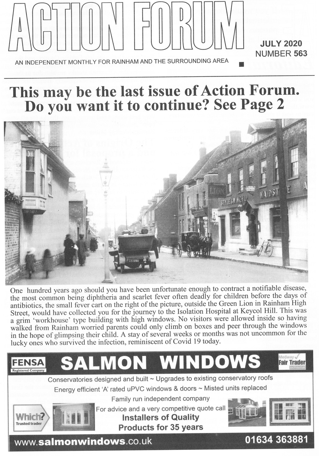
Action Forum Article Count: 234
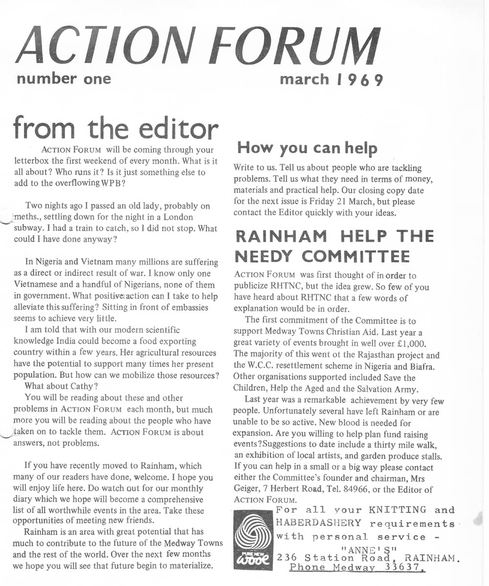
Action Forum is a free monthly magazine that is distributed to the Rainham area covering Wigmore, Parkwood and Hempstead as well. This archive covers old copies of the magazine dating back to its initial publication in 1969 and give a fascinating glimpse into life in Rainham over the last 50 years.
Link to Article Index - Action Forum Index - Photos and Articles from 1969 onwards