
These are old photo of Broad Walk Rainham which is now High Street/A2. Broadwalk was the section of the A2 between Rainham Watling Street junction of Mierscourt Road and Otterham Quay Lane and is currently where the Rose Inn and the Congregational Church are located. I believe the houses in the photo below no longer exist. From Kelly's Directory it appears that Broadwalk was renamed High Street in the 1930s along with other street name changes in Rainham. How Rainham Kent Street Names have changed over the years

I believe the houses above are the ones in the photo below to the left of the Chapel


- Details
- Category: Rainham Roads
Even in recent timeframes the local area has changed significantly and one example is Orchard Street. I believe land was retained to allow for a bypass to be built avoiding the centre of Rainham but when this plan was cancelled the land was then redeveloped.
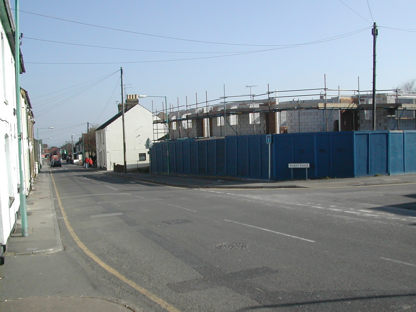
The photo below from 2001 looking towards Rainham shows the old Lukehurst warehouse with the green wall and corrugated tin roof and car sales yard before the site was cleared to build the new flats

Looking up Orchard Street towards Thames Avenue, 2001

Below: Looking towards Rainham with the cleared site after Lukehursts warehouse demolished showing view through to church and Millennium centre

Below: Site after Lukehursts warehouse demolished showing view through to church and Millennium centre

Below: Orchard Street Car sales site looking towards school

Below: Same location photo of new houses built on Orchard Car sales site, 2003

Providence Chapel Orchard Street, 2001

Orchard Street outside St Margarets School, 2001

New houses, 2003

Former Church Hall site, now flats on Hurst Close/Orchard Street

These photos of Orchard Street Rainham were taken in around 2002 before the bypass land was released and the new housing was built on the former Orchard Street Car Sales and Lukehursts green warehouse


Photos below of Orchard Street during winter of 1987 kindly provided by Darren H


- Details
- Category: Rainham Roads
The estate comprising of The Goldings and The Platters off Marshall Road was built from around 1979. These are some photos taken of the construction of the Goldings/Platters Farm estate from Marshall Road in 1980. During the building work several Dene holes were discovered which delayed the construction to excavate and then to fill the holes for houses to safely be built.

- Details
- Category: Rainham Roads
Pictures of historic hempstead kent. This photo is of Hempstead Hill looking towards the site of the old smallpox isolation hospital situated off Hoath Lane Wigmore. This photo was taken prior to the building of the A278 Link road to join the A2 to the M2 at junction 4 and appears to show that the road splits at the bottom of Hempstead Hill near Spekes Road and goes in the direction of Hoath Lane and Woodside as well as towards Darland Banks/Gillingham.
The road now only goes to the left towards Darland Banks and the right hand fork is a tunnel under the A278 Hoath Way nicknamed the Love Tunnel.
The buildings above the junction are the Smallpox Isolation hospital, named in the photo as Wigmore Hospital.


Hempstead Valley shopping centre shortly after construction in 1978
- Details
- Category: Rainham Roads
This old photo of Ivy Street Rainham Kent showing WE Jones Ivy Street Rainham - Woodhams Ales and Stouts was probably taken around 1915

This photo of Ivy Street Rainham towards the River Medway was taken in 2001 in a similar location to the shot above

- Details
- Category: Rainham Roads